
Every summer, millions of Americans wake up to hazy skies, poor air quality, and an important question:
Is the air safe to breathe today?”
That’s where a Smoke Map USA becomes an essential tool. Whether you’re planning a morning run, taking your kids to the park, travelling, or simply walking your dog, checking the latest smoke map can help you protect your health.
What Is a Smoke Map USA?
A Smoke Map USA is a real-time interactive map that shows where wildfire smoke is currently affecting air quality across the United States. Using satellite imagery, weather models, and air quality sensors, these maps track smoke movement hour by hour.
They allow you to:
- See where wildfire smoke is spreading
- Check your local air quality
- Monitor smoke forecasts for the next 24–72 hours
- Plan outdoor activities more safely
Why Wildfire Smoke Is Becoming a Bigger Problem
Wildfires have become more frequent and more intense across North America. Large fires in states like California, Oregon, Washington, Idaho, Montana, and even Canada can send smoke thousands of miles away.
In recent years, cities including:
- New York
- Chicago
- Minneapolis
- DetroitBoston
- Washington, D.C.
have experienced unhealthy air due to wildfire smoke travelling hundreds or even thousands of miles.

Why You Should Check a Smoke Map Every Day
Even if your local weather looks sunny, the air may contain dangerous levels of fine particles (PM2.5).
These microscopic particles can cause:
- Eye irritation
- Coughing
- Asthma attacks
- Breathing difficulties
- Heart problems in vulnerable individuals
Children, older adults, pregnant women, and people with lung or heart disease are especially at risk.
How to Read a Smoke Map
- 🟢 Green – Good air quality
- 🟡 Yellow – Moderate
- 🟠 Orange – Unhealthy for sensitive groups
- 🔴 Red – Unhealthy
- 🟣 Purple – Very unhealthy
- 🟤 Maroon – Hazardous
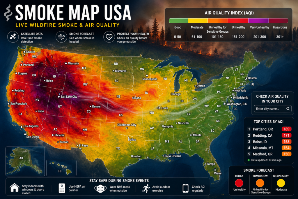
The darker the colour, the greater the health risk.
Tips to Stay Safe During Smoky Days
- Limit outdoor exercise
- Keep windows and doors closed
- Run a HEPA air purifier if available
- Wear a properly fitted N95 mask outdoors if smoke is heavy
- Check air quality updates throughout the day, as conditions can change quickly.
Why Smoke Maps Matter More Than Ever
Climate change and prolonged drought have increased wildfire activity across many regions. Smoke no longer affects only nearby communities—it can travel across entire states or even the continent.
A quick look at a Smoke Map USA can help you make smarter decisions about work, travel, outdoor sports, and family activities.
Final Thoughts
A Smoke Map USA is more than just a weather tool—it’s a daily health resource. By checking current smoke conditions before heading outside, you can reduce exposure to harmful air pollution and keep yourself and your family safer.Whether you’re commuting, hiking, exercising, or planning a weekend trip, taking a minute to review the latest smoke map is one of the simplest ways to protect your health.